Cuddington Rail Trail 4.5km Circular
Cuddington Railway Station, Warrington Road, Cuddington, Cheshire, CW8 2LE
To build your own Itinerary, click  to add an item to your Itinerary basket.
Already saved an Itinerary?


The twin villages of Cuddington and Sandiway were united as one parish in 1935 and are a major residential centre, served by good rail and road links. Cuddington is also at one end of Whitegate Way Country Park, accessible from Waste Lane. The Whitegate Way is slightly over 6 miles in length and follows the course of the railway branch line from Cuddington to Winsford which was closed in the 1960s. It has an excellent wide path, established woodland and varied views over the Cheshire countryside. However, only the start of Whitegate Way is seen from this walk. Download the rail trail leaflet here.
DISTANCE: 4.5km
MAP: OS Explorer Map, sheet 267 scale 1: 25,000
GROUND CONDITIONS: This route is not accessible by wheelchair. As much of the walk is along narrow paths and minor roads without footpaths or verges requiring single file walking, this walk is not recommended for large groups.
STILES: Three
KISSING GATES: Four
REFRESHMENTS: ‘The White Barn’ public house, a ‘Hungry Horse’, is very close to the station entrance
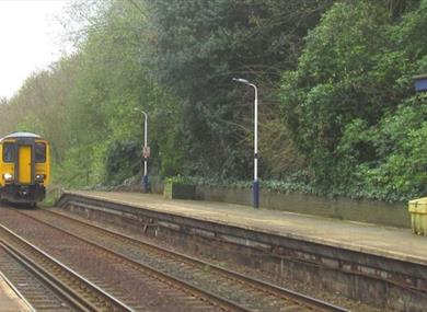
Start at Cuddington Railway Station on the Manchester platform side.
1. From Cuddington Station (Manchester platform), walk up the station approach, turn left, crossing the traffic lights onto Forest Road (A49). Keep on the left hand side of the road and use the bridge to cross the railway line.
2. Continue to walk down the A49. Carefully cross the very busy road to a marked footpath which will be seen on the opposite side of the road. Cuddington Rail Trail Route The twin villages of Cuddington and Sandiway were united as one parish in 1935 and are a major residential centre, served by good rail and road links. Cuddington is also at one end of Whitegate Way Country Park, accessible from Waste Lane. The Whitegate Way is slightly over 6 miles in length and follows the course of the railway branch line from Cuddington to Winsford which was closed in the 1960s. It has an excellent wide path, established woodland and varied views over the Cheshire countryside. However, only the start of Whitegate Way is seen from this walk.
3. Go through a kissing gate onto a narrow fenced path which can be muddy. Then, after about half a mile, go over a metal stile, up a short steep climb to the railway line.
4. Cross the railway line carefully and walk down steps with a stout metal rail and across another metal stile.
5. Shortly you reach Waste Lane. Turn right. There is attractive woodland on the right and a stream on the left.
6. At the end of Waste Lane, cross the busy Norley Road. There is a very short path (unmarked) immediately opposite, just to the left of the telegraph pole. Keep left after passing through this gap and soon turn right onto the established footpath through a kissing gate.
7. Soon you will reach on the left and below the path a large pond and high on the right a huge mansion. Here there is a wooden bench seat inviting you to rest awhile and enjoy the pleasant scene.
8. At the end of the fence, turn right through a kissing gate and across a stream.
9. Proceed to the T junction and turn left going downhill into what is Mill Lane.
10. After about 200 yards, now walking uphill, there is a green footpath sign on the right. Go through the gate, down the steps and into a field. The path takes you to the left. There are reed beds on the right of the field.
11. At the bottom (right bend) of the field cross a stile and turn right up Cuddington Lane. Mill House is on the right.
12. There is now no path or verge. You probably need to use both sides of the road at various points to be visible to traffic.
13. Turn right at the T junction and, passing the sign for Bryn Smithy on the left, walk up to the A49, the busy road which links Warrington with Whitchurch. Cross with care and walk into Smithy Lane opposite.
14. The lane is slightly uphill and may be muddy; you pass two metal gates across the road which ensure it is an ‘access only’ road. Go through the footpath gate on the right of these metal gates.
15. Soon, where the boundary path goes left, go straight ahead crossing the field down at first, and then up to the estate ahead. At paths T junction turn right.
16. Go through a kissing gate at the end of the path. You are now in Moorlands Avenue. Follow the road left and take the first right into Glebe Road not signed. Shortly, turn left onto A49. The station is about 100 yards away on the left.
| Open Christmas |
|---|
| Open New Year |
|---|
| 2024 (1 Jan 2024 - 31 Dec 2024) |
|---|
 Cuddington Railway Station, Cheshire
© Visit Chester. All Rights Reserved