Itinerary Planner

Winter Walking in Chester

Winter Walking in Chester

It may be cold outside, but winter can be the perfect time to embrace the outdoors and wander the historic city of Chester and its surrounding areas. We’ve put together a selection of ways to explore our beautiful city on foot this winter:

Chester City Centre Circular Walk

This is the ultimate way to explore the whole of the city, taking you from the Visitor Information Centre to along the Shropshire Union Canal, River Dee, Grosvenor Park and even around the racecourse. Experience everything Chester has to offer on this great circular walk!

Walk the City Walls

One of the main features of Chester (or Deva Victrix as it was once known) is the city walls – some of the most complete in the country. Originally Built by the Romans and fortified over the years by subsequent invaders such as the Vikings and Saxons, the city walls remain a great way to explore the city centre. On this walk you’ll take in some key sights from a great vantage point including the famous Eastgate Clock, King Charles’ Tower, the Water Tower as well as the River Dee and Shropshire Union Canal.

Take a short walk through Handbridge

Handbridge lies across the Old Dee Bridge from the city and much of Chester's Roman fortress was built from stone quarried here. The community lies on the old main road into North Wales and its name in Welsh is 'Treboeth', meaning 'burnt town or hot town', perhaps an indication that its buildings were not easily defended from raiders. Starting at The Ship Inn), just across the Old Dee Bridge from Lower Bridge Street, this short walk of around 1 mile takes in features of the area's rich history while giving wonderful views of the River Dee.

Follow in the footsteps of pilgrims on the Two Saints Way

The Two Saints Way is a 92-mile pilgrimage route between the cathedral cities of Chester and Lichfield. The route can be walked from either the north or the south, through the beautiful countryside of Cheshire and Staffordshire along footpaths, canal paths and lanes which link the villages, towns and cities along the way. For a great day’s walk, why not walk the route from Chester to the beautiful town on Nantwich. This 23.5-mile route From Chester Cathedral is mostly along canal paths and through pastureland, passing the dramatic Beeston Castle before ending at the fine market town of Nantwich.

Stroll through Caldy Valley Nature Park

Caldy Nature Park is a small area of wetland, woodland and meadows close to Chester city centre. Take this relaxing short walk to experience some of Cheshire’s beautiful wildlife whilst not too far from the city centre. This is a great way to relax and unwind in with this easy and accessible short walk.

Train your brain on a treasure hunt trail

Want to experience the historic city of Chester in a fun and innovative way? The Chester Treasure Hunt Trail is a great way to entertain yourself whilst exploring Chester. By following the clues around the city, you’ll learn while you walk! Your Trail adventure starts in the city centre at “The Cross” and along the 2-mile circular Trail route you’ll explore Chester’s quaint streets and old Roman walls. The Trail then takes you down to the River Dee and around the famous Eastgate Clock and Cathedral grounds before finishing at The Rows.  You’ll certainly discover some of Chester’s hidden gems along this Trail route!

Product Information

  1. Chester Centre 3.3 Mile / 6km Circular Walk

    Northgate Street, Chester

    Take in the historic city of Chester on this scenic circular walk.

    Add Chester Centre 3.3 Mile / 6km Circular Walk to your Itinerary

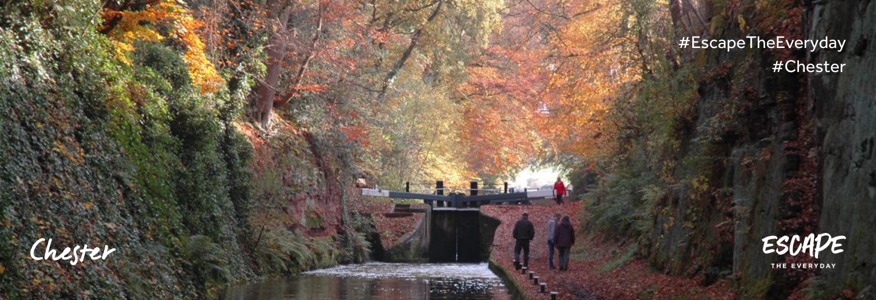
    Walking on the Shropshire Union Canal in Chester
    Chester City Centre Circular Walk
    Walking on the Shropshire Union Canal in Chester
    Chester City Centre Circular Walk

    This is the ultimate way to explore the whole of the city, taking you from the Visitor Information Centre along the Shropshire Union Canal, River Dee, through Grosvenor Park and even around the racecourse. Experience everything Chester has to offer on this great circular walk!

    Instructions:

    Start at the Visitor Information Centre at the Town Hall on Northgate Street

    1. Head north up Northgate Street, turning left onto Water Tower Street at The Liverpool Arms.

    2. Go through the city wall at the opening onto the canal tow path, heading west toward Telford’s Warehouse.

    3. Keep following the tow path under the bridges and past Telford’s Warehouse.

    4. Cross over the canal using the small bridge at the locks, then head down Catherine Street.

    5. Turn left onto New Crane Street.

    6. Turn slightly right to access the riverside path. Keeping the river on your right, follow the path to the Racecourse.

    7. You will arrive at the railway bridge, go under the bridge to access the Racecourse path. Follow this around and take in the views of the city.

    8. Exit the racecourse path onto the Little Roodee car park. Follow the river all the way to the Groves.

    9. Follow Souter’s Lane.

    10. Turn right onto Little St. John Street / Vicar’s Lane / Grosvenor Park Road and follow this, keeping Grosvenor Park on your right; then take The Headlands onto Dee Lane.

    11. Turn left on Dee Lane toward the A51 / Ring Road, Crossing the ring road onto Russell Street.

    12. Follow Russell Street to the canal.

    13. Turn left at the canal and, keeping it on your right, follow it for about 1km / 0.7miles.

    14. You have reached where you joined the canal towpath.

    Contact Details:

    Visitor Information Centre, Town Hall, Northgate Street, Chester, Cheshire, CH12HJ
  2. Chester City Walls

    Chester

    The city walls are the oldest, longest and most complete in Britain, parts of which are almost 2000 years old.

    Add Chester City Walls to your Itinerary

    Chester City Walls
    Chester City Walls

    The city walls are the oldest, longest and most complete in Britain, parts of which are almost 2000 years old.

    Chester is the only city in Britain that retains the full circuit of its ancient defensive walls. Walking the complete circuit gives wondrous views down into the city and gives a fantastic insight into Chester's long history. The main access onto the walls is at each of the four main gateways - Northgate, Eastgate, Watergate and Bridgegate, plus there are many other steps around the city, some including accessible ramps.

    Please note: Access to The Walls, Northgate

    The steps to the right of the Northgate will remain open which means pedestrians will be able to gain access to the wall at that point if they want to walk clockwise (towards King Charles Tower).  Pedestrians walking anticlockwise from KCT will be diverted off the walls at the right hand steps and taken to the next set of steps at Morgan's Mount.  It won't be possible to keep a through route open along the wall as part of the wall and core needs to be carefully dismantled.


    Contact Details:

    Vicar's Lane, Chester, Cheshire, CH1 1QX

    Tel:

    01244 351609
  3. Handbridge Short Walk

    Chester

    Handbridge lies across the Old Dee Bridge from the city and much of Chester's Roman fortress was built from stone quarried here. The community lies on the old main road into North Wales and it's name in Welsh is 'Treboeth', meaning 'burnt town or hot town', perhaps an indication that it's buildings were not easily defended from raiders.

    A view of Grosvenor Bridge from the Handbridge River Bank. Photo credit: John S. Turner

    Handbridge lies across the Old Dee Bridge from the city and much of Chester's Roman fortress was built from stone quarried here. The community lies on the old main road into North Wales and it's name in Welsh is 'Treboeth', meaning 'burnt town or hot town', perhaps an indication that it's buildings were not easily defended from raiders.

    Starting at The Ship Inn (what3words: ///thanks.pops.dinner), just across the Old Dee Bridge from Lower Bridge Street, this short walk of around 1 mile takes in features of the area's rich history while giving wonderful views of the River Dee.

    From The Ship Inn, walk uphill, away from the Old Dee Bridge, passing the entance to Edgar's Field and then Greenway Street.

    Handbrige turns sharp right a little before the junction with Eaton Road and becomes Overleigh Road. Continue along Overleigh Road, passing the church of St Mary without the Walls on your right, followed by rows of neat 19th century terraced houses, until you reach the entrance to River Lane on the right, immediately before the gates to Overleigh Cemetery (North).

    St Mary without the Walls was completed in 1887.

    Turn down River Lane, walking the length of the lane, keeping the northern side of Overleigh Cemetery on your left.

    Overleigh Cemetery dates from the late 1840s and houses a fascinating array of Victorian monuments.

    River Lane takes a sharp turn to the right. Continue along the lane until it meets Greenway Street and the entrance to Edgar's Field. Then either continue along Greenway Street (cobbled surface) and then turn left onto Handbridge to return to The Ship Inn OR continue through Edgar's Field to The Ship Inn.

    Edgar's Field – Tradition says this is spot where King Edgar, King of Wessex and All England, was rowed along the River Dee by eight tributary Kings in AD 973. The field is also home to a Roman shrine of the Godess Minerva.

    Greenway Street – the heart of Handbridge's traditional salmon fishing community.

    Contact Details:

    The Ship Inn, 18 Handbridge, Chester, Cheshire, CH4 7JE
  4. Two Saints Way

    Pilgrimage route and long-distance walk between Chester and Lichfield

    St Mary's Church, Nantwich - Two Saints Way
    Beeston Castle- Two Saints Way
    Walkers walking the route - Two Saints Way
    A map of the route - Two Saints Way
    St Mary's Church, Nantwich - Two Saints Way
    Beeston Castle- Two Saints Way
    Walkers walking the route - Two Saints Way
    A map of the route - Two Saints Way

    Pilgrimage route and long-distance walk between Chester and Lichfield

    ​The Two Saints Way is a 92-mile pilgrimage route between the cathedral cities of Chester and Lichfield. The route can be walked from either the north or the south,  through the beautiful countryside of Cheshire and Staffordshire along footpaths, canal paths and lanes which link the villages, towns and cities along the way. ​If you walk from Chester to Lichfield the easier walking is at the beginning and you have time to prepare for the hillier section in Staffordshire. However, if you walk between October and March from Lichfield to Chester the views are often better as the sun is behind you.

    The Route

    START: what3words: ///pints.panels.rainy

    Chester to Nantwich

    From Chester Cathedral the route is mostly along canal paths and through pastureland, passing the dramatic Beeston Castle before ending at the fine market town of Nantwich. ​Distance - 23.5 miles

    Nantwich to Stoke-on-Trent

    Along this rural section are notable churches such as the intriguing Primitive Methodist Chapel at Englesea Brook and villages with traditional black and white timbered houses and pubs. ​Distance - 25.5 miles

    Stoke-on-Trent to Stafford

    ​Starting out in the city of Stoke-on-Trent with the Staffordshire Hoard treasures at the Potteries Museum, the route continues south past Trentham Gardens and through the charming town of Stone following the Trent Valley. ​Distance - 23 miles

    Stafford to Lichfield

    ​On leaving Stafford the route crosses the extensive moorland and woodland of Cannock Chase, an Area of Outstanding Natural Beauty, before the last few miles into Lichfield, past the cathedral and ending at St Chad’s Well. ​Distance 20 miles

    Contact Details:

    Chester - Staffordshire - Litchfield

    Website

    Web Site

  5. Walks for All - Caldy Valley Nature Park

    Chester

    Caldy Nature Park is a small area of wetland, woodland and meadows close to Chester city centre. The active Friends group organise events and activities throughout the year including practical task days.

    Add Walks for All - Caldy Valley Nature Park to your Itinerary

    Grade: Easy Distance: 1.2km/1miles Time: 1-1.5 hours Start: Car Park off Caldy Valley Road (A41) | what3words: ///nods.violin.zones Map: OS Explorer 266 Terrain: Easily accessible Caldy Nature Park is a small area of wetland, woodland and meadows close to Chester city centre. The active Friends group organise events and activities throughout the year including practical task days. From the car park there is a circular route around the nature park. The surface of the path is firm and compact with no gradients steeper than 1:10. There are several benches around the site, there are other paths within the park however some of these have steps. Access to the free car par is off Caldy Valley Road (A41) there is a dedicated disable parking bay and the car parked open all hours. There are no refreshments or toilets on site however there is a supermarket café nearby as well as public house.

    Contact Details:

    Car Park off Caldy Valley Road (A41), Chester, Cheshire, CH3 5PR

    Tel:

    0151 357 1991
  6. The Chester Treasure Hunt Trail

    Chester

    The Chester Treasure Hunt Trail is a self-guided Treasure Hunt which will get you exploring around this historical city. If you’re looking for things to do with family and friends when visiting Chester then this is the activity for you!

    Add The Chester Treasure Hunt Trail to your Itinerary

    Treasure Hunt Trail
    Treasure Hunt Trail
    Treasure Hunt Trail
    Treasure Hunt Trail
    Treasure Hunt Trail
    Treasure Hunt Trail
    Treasure Hunt Trail
    Treasure Hunt Trail

    The Chester Treasure Hunt Trail is a self guided Treasure Hunt which will get you exploring around this historical city. If you’re looking for things to do with family and friends when visiting Chester then this is the activity for you! Can you follow the route and solve the sneaky clues?

    Your Trail adventure starts in the city centre at “The Cross” and along the 2 mile circular Trail route you’ll explore Chester’s quaint streets and old Roman walls. The Trail then takes you down to the River Dee and around the famous Eastgate Clock and Cathedral grounds before finishing at The Rows.  You’ll certainly discover some of Chester’s hidden gems along this Trail route!

    Along the Trail we’ve set the clue answers on permanent features such as historical buildings, monuments and quirky signs, so you’ll have to keep your eyes peeled to crack this Treasure Hunt.

    This unique way to explore Chester is suitable for both children and adults from the age 6 years and up, so everyone can get involved with following the route and solving the clues.

    Download and print your Trail booklet from the Treasure Trails website for £9.99. Or get a copy posted to you by 1st class post for £11.48. One Trail booklet can be shared between 4-5 people making it a great value and enjoyable way to explore Chester.

    For more information about the Chester Treasure Hunt Trail click on the “visit website” button above.

    Happy Trailing!

    Contact Details:

    Watergate Street, Chester, Cheshire, CH1 2LE

    Tel:

    01872 263692

    Website

    Web Site

Itinerary Distances

FromToDistance * (metric)
Chester Centre 3.3 Mile / 6km Circular Walk (53.19173,-2.89272)Chester City Walls (53.18959,-2.88594)0.46
Chester City Walls (53.18959,-2.88594)Walks for All - Caldy Valley Nature Park (53.18502,-2.85608)1.85
Walks for All - Caldy Valley Nature Park (53.18502,-2.85608)The Chester Treasure Hunt Trail (53.18926,-2.89209)2.2
Total Distance *4.51 miles
Estimated Journey Time9 minutes

* Approximate distance by road

Don't Miss

Don't Miss

Don't Miss

Don't Miss

Don't Miss

Don't Miss

Don't Miss

Don't Miss

Don't Miss